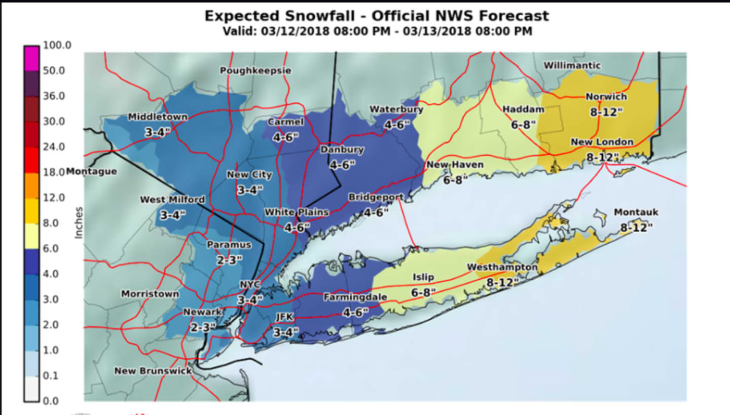

Most of the tristate area is expected to see 3-4 inches of accumulation, with a range of 4 to 6 inches in the eastern sections of Westchester, Putnam and Dutchess and all of Fairfield County. (See images above.)
A Winter Storm Warning is in effect for Fairfield County from 8 p.m. Monday until 6 p.m. Tuesday. A Winter Weather Advisory has been issued for the entire Hudson Valley as well as Bergen and Passaic counties from 8 p.m. Monday until noon Tuesday.
Snow will arrive late Monday evening and continue overnight with new snow accumulation of 1 to 3 inches possible overnight.
Snow will continue until around 1 p.m. Tuesday with new accumulation of another 1 to 3 inches possible. There's a chance of a bit more snow until around 7 p.m. Tuesday.
Heavy, wet snow combined with strong wind gusts up to nearly 30 mph will cause some downed trees, tree limbs and power lines, particularly in Fairfield County and areas farther east as the brunt of the storm is expected to slam coastal areas in New England, including Boston.
Wednesday will be mostly cloudy with a high near 40 and a slight chance of morning and late afternoon and early evening snow showers.
Thursday will be partly sunny with a high around 40.
Check back to Daily Voice for updates.
Click here to follow Daily Voice Brookfield and receive free news updates.